The drive to Chan Chich went quite well, but was very long. The last 35 miles on dirt roads of varying quality took nearly 3 hours. Here's the route from Google maps.
 |
| Looks easy and fast. Google Maps says less than 4 hours start to finish! |
And here is what the last part actually looks like according to Google Earth.
 |
| We left the paved roads when we turned north near the Crique Blanco Zibal. Did I mention no phone service after the first 5 or 10 miles on the dirt track? |
I left home at 7AM. Dawn on the beach was promising.
 |
| Nice calm sea made for a fast and easy boat trip to Placencia to meet up with Melanie. |
We left Placencia at 9AM with me driving Melanie's Kia. We planned to reach Chan Chich before 2PM, just before the restaurant stopped serving lunch. We made our first stop near Dangriga at a service station that has clean bathrooms. I took this photo of the sign on inside of the bathroom stall.
 |
| In Belize, and many developing countries, you do not flush any thing down toilet except poop and pee, not even toilet paper. There is always a conveniently placed trash can beside each toilet. Hang on to your dreams. |
I didn't take any photos along the newly engineered and resurfaced Hummingbird Highway. It goes through the stunning Maya Mountains and is now a joy to travel on. We missed the turn onto the dirt track and stopped for directions at a hardware store not too far from the Mennonite village of Spanish Lookout. These Mennonites have embraced many aspects of machines and technology and have massive modern farms that supply Belize with all manner of vegetables, meat, poultry, dairy products. The clerk I asked for directions to get to Yalbac Road was not able to help me, but he did suggest asking another customer in the store because "he should know". So I did. Mr. John Roberson, as it turns out, knew exactly how to get to Yalbac Road because
he built most of the roads in the area! He drew a map, gave me his phone number, and said to turn around, take the first major right on Farmers Express Road and then take the next left onto
Roberson Road - his road. Did we find the right person or what?! Coincidentally, he and his wife were taking their visitors down to Monkey River Village the next day. Belize is such a village, you will discover some link with anyone you speak to for more than 5 minutes.
 |
| Corner of Farmers Express and Roberson Road. |
Finally Yalbac Road, which went on forever! We did not see another vehicle until we reached Chan Chich.
 |
| Still surrounded by farm fields, jungle is up ahead. No phone service from here on. No electricity and only a couple of homesteads. |
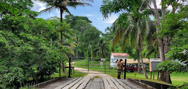
At some point we entered a reserve that is used by US and British military for jungle training. We had to go through checkpoints and show that we had reservations for Chan Chich.
 |
| First checkpoint. |
The road become much hillier and a bit rougher, probably due to army vehicles. We passed through Busby Camp, which is where the military folks stay while on training missions.
 |
| Just a few old-fashioned barracks type buildings were up ahead. |
 |
| Looking back south toward fields. |
There were 3 or 4 very tricky spots of mud with steep ditches on either side. I actually had to get out of the car to scope out the best way to get through without getting stuck or bottoming out the Kia., which fortunately is fairly high.
 |
| Second checkpoint |
Not too far now . . .
 |
| Chan Chich Road - only 7 miles to go! |
And finally we're here. Too late for lunch, but we were greeted with deliciously cold allspice tea and promises for an early dinner.
 |
| Melanie in front of our accommodation. |
We averaged 25 miles an hour overall, much slower through the jungle. Good thing I like to drive. Silly us to trust Google Maps to account for dirt roads when calculating driving times! In the end, it was worth it.


